
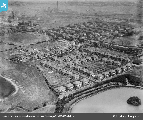
EPW054437 ENGLAND (1937). The residential area adjacent to Firs Park Boating Lake, Westleigh, 1937. This image has been produced from a damaged negative.
© Copyright OpenStreetMap contributors and licensed by the OpenStreetMap Foundation. 2026. Cartography is licensed as CC BY-SA.
Nearby Images (4)
EPW054437

EPW054438

EPW054439

EPW054436

Details
| Title | [EPW054437] The residential area adjacent to Firs Park Boating Lake, Westleigh, 1937. This image has been produced from a damaged negative. |
| Reference | EPW054437 |
| Date | 30-July-1937 |
| Link | |
| Place name | WESTLEIGH |
| Parish | |
| District | |
| Country | ENGLAND |
| Easting / Northing | 364530, 400810 |
| Longitude / Latitude | -2.5348159992382, 53.50253712461 |
| National Grid Reference | SD645008 |
Pins
Be the first to add a comment to this image!