
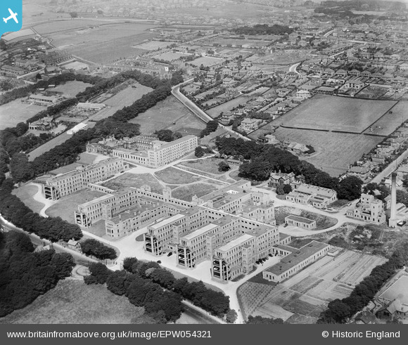
EPW054321 ENGLAND (1937). The New Royal Infirmary, Bradford, 1937
© Copyright OpenStreetMap contributors and licensed by the OpenStreetMap Foundation. 2026. Cartography is licensed as CC BY-SA.
Nearby Images (3)
EPW054321

EPW045326

EPW045325

Details
| Title | [EPW054321] The New Royal Infirmary, Bradford, 1937 |
| Reference | EPW054321 |
| Date | 14-July-1937 |
| Link | |
| Place name | BRADFORD |
| Parish | |
| District | |
| Country | ENGLAND |
| Easting / Northing | 413485, 434537 |
| Longitude / Latitude | -1.7952051601005, 53.806738288605 |
| National Grid Reference | SE135345 |
Pins
Be the first to add a comment to this image!