
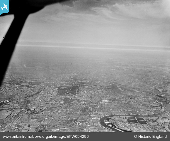
EPW054296 ENGLAND (1937). An infrared photograph showing a large area of London from Hammersmith to Hyde Park and beyond, Westminster, from the west, 1937
© Copyright OpenStreetMap contributors and licensed by the OpenStreetMap Foundation. 2026. Cartography is licensed as CC BY-SA.
Nearby Images (4)
EPW054296

EAW005239

EPW046250

EPW046249

Details
| Title | [EPW054296] An infrared photograph showing a large area of London from Hammersmith to Hyde Park and beyond, Westminster, from the west, 1937 |
| Reference | EPW054296 |
| Date | 14-July-1937 |
| Link | |
| Place name | WESTMINSTER |
| Parish | |
| District | |
| Country | ENGLAND |
| Easting / Northing | 528437, 179353 |
| Longitude / Latitude | -0.14949282752549, 51.498022349608 |
| National Grid Reference | TQ284794 |
Pins

Alan McFaden |
Friday 20th of June 2014 05:43:26 PM | |
|
Alan McFaden |
Friday 20th of June 2014 05:42:34 PM | |
|
Alan McFaden |
Friday 20th of June 2014 05:41:56 PM | |
|
Alan McFaden |
Tuesday 1st of October 2013 10:24:12 AM |


