
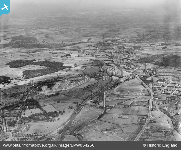
EPW054256 ENGLAND (1937). The River Colne valley at Deighton and Colne Bridge, Huddersfield, from the south-west, 1937
© Copyright OpenStreetMap contributors and licensed by the OpenStreetMap Foundation. 2026. Cartography is licensed as CC BY-SA.
Nearby Images (2)
EPW054256

EPW016132

Details
| Title | [EPW054256] The River Colne valley at Deighton and Colne Bridge, Huddersfield, from the south-west, 1937 |
| Reference | EPW054256 |
| Date | 13-July-1937 |
| Link | |
| Place name | HUDDERSFIELD |
| Parish | |
| District | |
| Country | ENGLAND |
| Easting / Northing | 415700, 418750 |
| Longitude / Latitude | -1.7623683140943, 53.66476633607 |
| National Grid Reference | SE157188 |
Pins

Badger |
Tuesday 1st of March 2022 09:21:27 PM | |
|
MrTois |
Sunday 12th of September 2021 12:00:58 PM | |
|
MrTois |
Sunday 12th of September 2021 11:53:12 AM | |
|
MrTois |
Sunday 12th of September 2021 11:46:37 AM | |
|
David960 |
Monday 6th of August 2018 01:04:16 PM | |
|
David960 |
Monday 6th of August 2018 01:03:56 PM | |
 |
RichBarker |
Monday 28th of September 2015 06:42:14 PM |
|
RichBarker |
Monday 28th of September 2015 06:20:45 PM | |
|
David Slocombe |
Wednesday 29th of January 2014 05:34:20 PM |
