
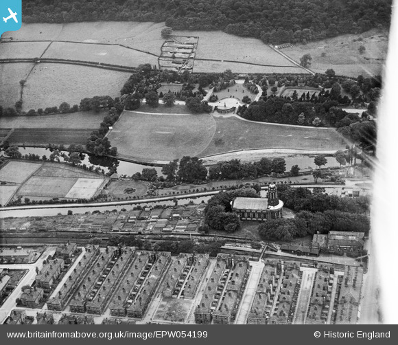
EPW054199 ENGLAND (1937). The Congregational Church and Roberts Park, Saltaire, 1937
© Copyright OpenStreetMap contributors and licensed by the OpenStreetMap Foundation. 2026. Cartography is licensed as CC BY-SA.
Nearby Images (7)
EPW054199

EPW054192

EPW054191

EPW054202

EPW054197

EPW054207

EPW054198

Details
| Title | [EPW054199] The Congregational Church and Roberts Park, Saltaire, 1937 |
| Reference | EPW054199 |
| Date | 13-July-1937 |
| Link | |
| Place name | SALTAIRE |
| Parish | |
| District | |
| Country | ENGLAND |
| Easting / Northing | 413808, 438201 |
| Longitude / Latitude | -1.7901353189123, 53.83966519713 |
| National Grid Reference | SE138382 |
Pins
Be the first to add a comment to this image!