
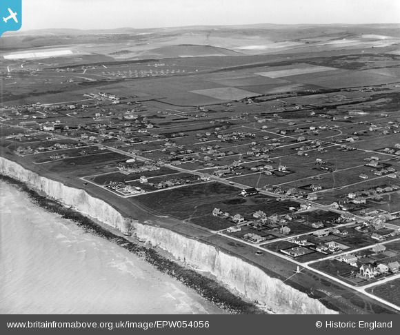
EPW054056 ENGLAND (1937). Residential development, Peacehaven, from the south-east, 1937
© Copyright OpenStreetMap contributors and licensed by the OpenStreetMap Foundation. 2025. Cartography is licensed as CC BY-SA.
Nearby Images (2)
EPW054056

EPW041391

Details
| Title | [EPW054056] Residential development, Peacehaven, from the south-east, 1937 |
| Reference | EPW054056 |
| Date | June-1937 |
| Link | |
| Place name | PEACEHAVEN |
| Parish | PEACEHAVEN |
| District | |
| Country | ENGLAND |
| Easting / Northing | 540683, 101004 |
| Longitude / Latitude | -0.0037842592733501, 50.790944560895 |
| National Grid Reference | TQ407010 |
Pins

vandyke4ad |
Wednesday 22nd of October 2014 03:06:58 PM |