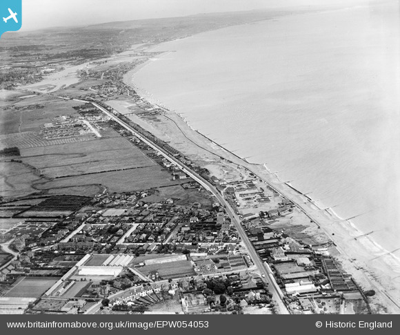
EPW054053 ENGLAND (1937). The coastline from South Lancing to Shoreham-by-Sea, Lancing, from the west, 1937
© Copyright OpenStreetMap contributors and licensed by the OpenStreetMap Foundation. 2026. Cartography is licensed as CC BY-SA.
Details
| Title | [EPW054053] The coastline from South Lancing to Shoreham-by-Sea, Lancing, from the west, 1937 |
| Reference | EPW054053 |
| Date | June-1937 |
| Link | |
| Place name | LANCING |
| Parish | LANCING |
| District | |
| Country | ENGLAND |
| Easting / Northing | 519042, 103946 |
| Longitude / Latitude | -0.30974852284027, 50.822241799133 |
| National Grid Reference | TQ190039 |
Pins

SAS |
Tuesday 29th of November 2016 03:09:12 AM | |

SAS |
Tuesday 29th of November 2016 03:07:07 AM | |

Anne |
Thursday 13th of August 2015 03:06:08 PM | |

greenchief |
Wednesday 6th of November 2013 12:11:00 PM | |

greenchief |
Wednesday 6th of November 2013 12:10:00 PM | |

greenchief |
Wednesday 6th of November 2013 12:08:40 PM | |

greenchief |
Wednesday 6th of November 2013 12:06:56 PM | |

greenchief |
Wednesday 6th of November 2013 11:53:38 AM | |

greenchief |
Wednesday 6th of November 2013 11:52:47 AM | |

greenchief |
Wednesday 6th of November 2013 11:51:34 AM | |

greenchief |
Wednesday 6th of November 2013 11:51:00 AM | |

greenchief |
Wednesday 6th of November 2013 11:50:11 AM | |

greenchief |
Wednesday 6th of November 2013 11:48:41 AM |


![[EPW054053] The coastline from South Lancing to Shoreham-by-Sea, Lancing, from the west, 1937](http://britainfromabove.org.uk/sites/all/libraries/aerofilms-images/public/100x100/EPW/054/EPW054053.jpg)
![[EAW022747] Lancing Beach and the village looking towards the South Downs, Lancing, from the south-east, 1949](http://britainfromabove.org.uk/sites/all/libraries/aerofilms-images/public/100x100/EAW/022/EAW022747.jpg)