
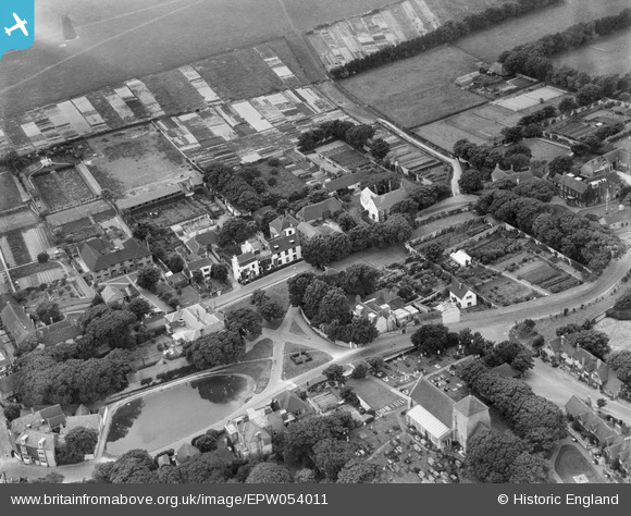
EPW054011 ENGLAND (1937). North End House, The Green and environs, Rottingdean, 1937
© Copyright OpenStreetMap contributors and licensed by the OpenStreetMap Foundation. 2026. Cartography is licensed as CC BY-SA.
Nearby Images (20)
EPW054011

EPW054010

EPW054006

EPW054005

EPW054012

EPW054004

EPW054008

EPW054003

EPW054007

EPW054009

EPW035302

EPW041382

EPW018061

EPW018055

EPW018058

EPW017726

EPW017731

EPW017266

EPW017263

EPW017268

Details
| Title | [EPW054011] North End House, The Green and environs, Rottingdean, 1937 |
| Reference | EPW054011 |
| Date | June-1937 |
| Link | |
| Place name | ROTTINGDEAN |
| Parish | ROTTINGDEAN |
| District | |
| Country | ENGLAND |
| Easting / Northing | 536832, 102588 |
| Longitude / Latitude | -0.057803613908257, 50.806104237821 |
| National Grid Reference | TQ368026 |
Pins
Be the first to add a comment to this image!