
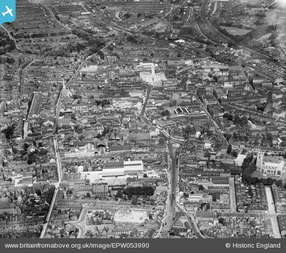
EPW053990 ENGLAND (1937). George Street and the town centre, Luton, from the south-east, 1937
© Copyright OpenStreetMap contributors and licensed by the OpenStreetMap Foundation. 2026. Cartography is licensed as CC BY-SA.
Nearby Images (11)
EPW053990

EPW022394

EPW053992

EAW016048

EPW019227

EPW026494

EPW019219

EPW022396

EAW016040

EPW053993

EPW053991

Details
| Title | [EPW053990] George Street and the town centre, Luton, from the south-east, 1937 |
| Reference | EPW053990 |
| Date | June-1937 |
| Link | |
| Place name | LUTON |
| Parish | |
| District | |
| Country | ENGLAND |
| Easting / Northing | 509316, 221086 |
| Longitude / Latitude | -0.41178726939209, 51.877173565694 |
| National Grid Reference | TL093211 |
Pins

Class31 |
Saturday 5th of July 2014 08:53:32 AM | |
|
Class31 |
Saturday 5th of July 2014 08:52:27 AM | |

melgibbs |
Tuesday 21st of January 2014 07:55:39 PM |

