
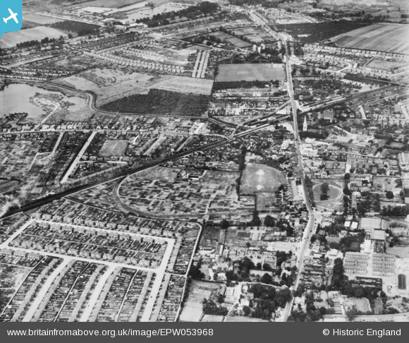
EPW053968 ENGLAND (1937). High Street and environs, Feltham, 1937. This image has been produced from a copy-negative.
© Copyright OpenStreetMap contributors and licensed by the OpenStreetMap Foundation. 2026. Cartography is licensed as CC BY-SA.
Nearby Images (4)
EPW053968

EPW053973

EPW023383

EPW023382

Details
| Title | [EPW053968] High Street and environs, Feltham, 1937. This image has been produced from a copy-negative. |
| Reference | EPW053968 |
| Date | June-1937 |
| Link | |
| Place name | FELTHAM |
| Parish | |
| District | |
| Country | ENGLAND |
| Easting / Northing | 510420, 173172 |
| Longitude / Latitude | -0.41089564318425, 51.446268373646 |
| National Grid Reference | TQ104732 |
Pins

waylou |
Sunday 1st of March 2026 03:57:40 AM |