
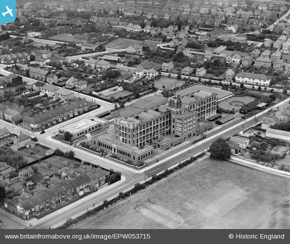
EPW053715 ENGLAND (1937). The Timpson Shoe Factory and the surrounding residential area, Kettering, 1937
© Copyright OpenStreetMap contributors and licensed by the OpenStreetMap Foundation. 2026. Cartography is licensed as CC BY-SA.
Nearby Images (7)
EPW053715

EPW053718

EPW053713

EPW053716

EPW053714

EPW053717

EPW053712

Details
| Title | [EPW053715] The Timpson Shoe Factory and the surrounding residential area, Kettering, 1937 |
| Reference | EPW053715 |
| Date | June-1937 |
| Link | |
| Place name | KETTERING |
| Parish | |
| District | |
| Country | ENGLAND |
| Easting / Northing | 487225, 280005 |
| Longitude / Latitude | -0.717515612969, 52.410707371962 |
| National Grid Reference | SP872800 |
Pins
Be the first to add a comment to this image!