
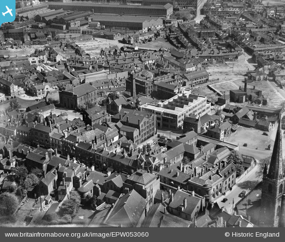
EPW053060 ENGLAND (1937). The High Street, the Grainger and Smith Ltd Works on King Street and environs, Dudley, 1937
© Copyright OpenStreetMap contributors and licensed by the OpenStreetMap Foundation. 2026. Cartography is licensed as CC BY-SA.
Nearby Images (15)
EPW053060

EPW053062

EPW053063

EPW053069

EPW053067

EPW053068

EPW053061

EPW053066

EPW053059

EPW022587

EPW053064

EPW053065

EPW053057

EPW053058

EPW053075

Details
| Title | [EPW053060] The High Street, the Grainger and Smith Ltd Works on King Street and environs, Dudley, 1937 |
| Reference | EPW053060 |
| Date | 18-May-1937 |
| Link | |
| Place name | DUDLEY |
| Parish | |
| District | |
| Country | ENGLAND |
| Easting / Northing | 394343, 290100 |
| Longitude / Latitude | -2.0833583848635, 52.508398054574 |
| National Grid Reference | SO943901 |
Pins

Steve |
Wednesday 7th of May 2025 05:41:24 PM | |
|
mikbex |
Friday 18th of February 2022 08:02:10 PM | |

black country history hunter |
Thursday 22nd of October 2020 09:59:57 PM | |
|
black country history hunter |
Thursday 22nd of October 2020 09:51:51 PM | |
|
black country history hunter |
Wednesday 9th of September 2015 01:24:17 AM | |
|
black country history hunter |
Wednesday 9th of September 2015 01:23:26 AM |