
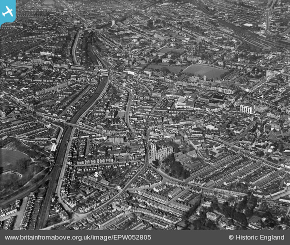
EPW052805 ENGLAND (1937). Tamworth Road and surrounding area, Croydon, from the south-west, 1937
© Copyright OpenStreetMap contributors and licensed by the OpenStreetMap Foundation. 2026. Cartography is licensed as CC BY-SA.
Nearby Images (4)
EPW052805

EPW021425

EAW047595

EAW047596

Details
| Title | [EPW052805] Tamworth Road and surrounding area, Croydon, from the south-west, 1937 |
| Reference | EPW052805 |
| Date | 3-April-1937 |
| Link | |
| Place name | CROYDON |
| Parish | |
| District | |
| Country | ENGLAND |
| Easting / Northing | 531869, 165413 |
| Longitude / Latitude | -0.10526578762691, 51.371943862357 |
| National Grid Reference | TQ319654 |
Pins

vakart |
Sunday 19th of November 2023 07:31:46 AM | |

TerryhaynesBFA |
Wednesday 10th of May 2017 03:30:07 PM | |
|
P Carey |
Tuesday 25th of March 2014 12:28:38 PM | |
|
P Carey |
Tuesday 25th of March 2014 12:27:12 PM |