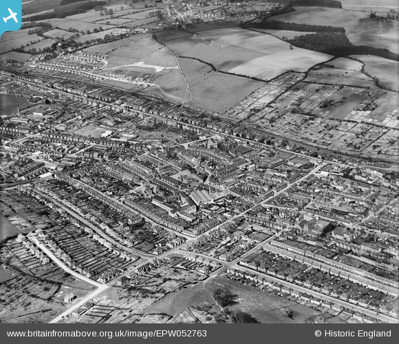
EPW052763 ENGLAND (1937). The town around Desborough Avenue and environs, High Wycombe, from the south-east, 1937
© Copyright OpenStreetMap contributors and licensed by the OpenStreetMap Foundation. 2024. Cartography is licensed as CC BY-SA.
Nearby Images (11)
Details
| Title | [EPW052763] The town around Desborough Avenue and environs, High Wycombe, from the south-east, 1937 |
| Reference | EPW052763 |
| Date | 24-March-1937 |
| Link | |
| Place name | HIGH WYCOMBE |
| Parish | |
| District | |
| Country | ENGLAND |
| Easting / Northing | 485723, 192988 |
| Longitude / Latitude | -0.76139268657022, 51.62869936221 |
| National Grid Reference | SU857930 |
Pins
Be the first to add a comment to this image!


![[EPW052763] The town around Desborough Avenue and environs, High Wycombe, from the south-east, 1937](http://britainfromabove.org.uk/sites/all/libraries/aerofilms-images/public/100x100/EPW/052/EPW052763.jpg)
![[EPW055334] The William Birch and Co Furniture Works, High Wycombe, 1937](http://britainfromabove.org.uk/sites/all/libraries/aerofilms-images/public/100x100/EPW/055/EPW055334.jpg)
![[EPW054582] The William Birch Ltd Furniture Factory on Leigh Street, High Wycombe, 1937](http://britainfromabove.org.uk/sites/all/libraries/aerofilms-images/public/100x100/EPW/054/EPW054582.jpg)
![[EPW055330] The William Birch and Co Furniture Works, High Wycombe, 1937](http://britainfromabove.org.uk/sites/all/libraries/aerofilms-images/public/100x100/EPW/055/EPW055330.jpg)
![[EPW055331] The William Birch and Co Furniture Works, High Wycombe, 1937](http://britainfromabove.org.uk/sites/all/libraries/aerofilms-images/public/100x100/EPW/055/EPW055331.jpg)
![[EPW054576] William Birch Ltd Furniture Works, High Wycombe, 1937](http://britainfromabove.org.uk/sites/all/libraries/aerofilms-images/public/100x100/EPW/054/EPW054576.jpg)
![[EPW054581] The William Birch Ltd Furniture Factory on Leigh Street, High Wycombe, 1937](http://britainfromabove.org.uk/sites/all/libraries/aerofilms-images/public/100x100/EPW/054/EPW054581.jpg)
![[EPW054578] The William Birch Ltd Furniture Factory on Leigh Street, High Wycombe, 1937](http://britainfromabove.org.uk/sites/all/libraries/aerofilms-images/public/100x100/EPW/054/EPW054578.jpg)
![[EPW055333] The William Birch and Co Furniture Works, High Wycombe, 1937](http://britainfromabove.org.uk/sites/all/libraries/aerofilms-images/public/100x100/EPW/055/EPW055333.jpg)
![[EPW055332] The William Birch and Co Furniture Works, High Wycombe, 1937](http://britainfromabove.org.uk/sites/all/libraries/aerofilms-images/public/100x100/EPW/055/EPW055332.jpg)
![[EPW055328] The William Birch and Co Furniture Works, High Wycombe, 1937](http://britainfromabove.org.uk/sites/all/libraries/aerofilms-images/public/100x100/EPW/055/EPW055328.jpg)