
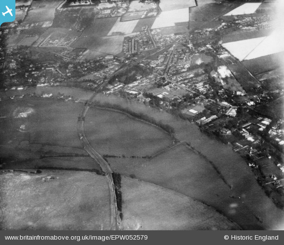
EPW052579 ENGLAND (1937). The River Thames near Cock Marsh, Bourne End, 1937. This image has been produced from a copy-negative.
© Copyright OpenStreetMap contributors and licensed by the OpenStreetMap Foundation. 2026. Cartography is licensed as CC BY-SA.
Nearby Images (3)
EPW052579

EAW028009

EPW052581

Details
| Title | [EPW052579] The River Thames near Cock Marsh, Bourne End, 1937. This image has been produced from a copy-negative. |
| Reference | EPW052579 |
| Date | 1-March-1937 |
| Link | |
| Place name | BOURNE END |
| Parish | WOOBURN |
| District | |
| Country | ENGLAND |
| Easting / Northing | 489345, 186737 |
| Longitude / Latitude | -0.71066527744867, 51.571938800612 |
| National Grid Reference | SU893867 |
Pins
Be the first to add a comment to this image!