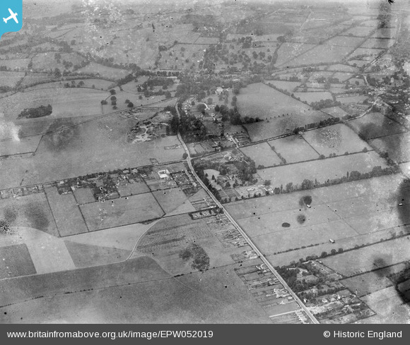
EPW052019 ENGLAND (1936). The junction of Holyport Road and Windsor Road prior to the construction of the Maidenhead by-pass, Bray Wick, 1936
© Copyright OpenStreetMap contributors and licensed by the OpenStreetMap Foundation. 2026. Cartography is licensed as CC BY-SA.
Details
| Title | [EPW052019] The junction of Holyport Road and Windsor Road prior to the construction of the Maidenhead by-pass, Bray Wick, 1936 |
| Reference | EPW052019 |
| Date | October-1936 |
| Link | |
| Place name | BRAY WICK |
| Parish | BRAY |
| District | |
| Country | ENGLAND |
| Easting / Northing | 490135, 178648 |
| Longitude / Latitude | -0.7013394132691, 51.499091807144 |
| National Grid Reference | SU901786 |
Pins

designking |
Monday 16th of December 2019 03:52:31 PM |


![[EPW052019] The junction of Holyport Road and Windsor Road prior to the construction of the Maidenhead by-pass, Bray Wick, 1936](http://britainfromabove.org.uk/sites/all/libraries/aerofilms-images/public/100x100/EPW/052/EPW052019.jpg)
![[EPW052021] The junction of Holyport Road and Windsor Road prior to the construction of the Maidenhead by-pass, Bray Wick, 1936](http://britainfromabove.org.uk/sites/all/libraries/aerofilms-images/public/100x100/EPW/052/EPW052021.jpg)