
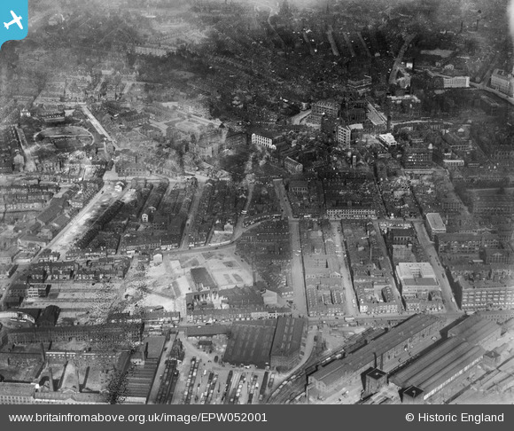
EPW052001 ENGLAND (1936). West Street and environs showing building clearance in advance of new road construction, Leeds, 1936. This image has been produced from a damaged negative.
© Copyright OpenStreetMap contributors and licensed by the OpenStreetMap Foundation. 2026. Cartography is licensed as CC BY-SA.
Nearby Images (13)
EPW052001

EPW052002

EPW052005

EPW052006

EPW052007

EPW052003

EPW052004

EPW052016

EPW052014

EPW052015

EPW052018

EPW052017

EAW015742

Details
| Title | [EPW052001] West Street and environs showing building clearance in advance of new road construction, Leeds, 1936. This image has been produced from a damaged negative. |
| Reference | EPW052001 |
| Date | October-1936 |
| Link | |
| Place name | LEEDS |
| Parish | |
| District | |
| Country | ENGLAND |
| Easting / Northing | 429312, 433752 |
| Longitude / Latitude | -1.5549232531318, 53.799030921918 |
| National Grid Reference | SE293338 |
Pins
Be the first to add a comment to this image!