
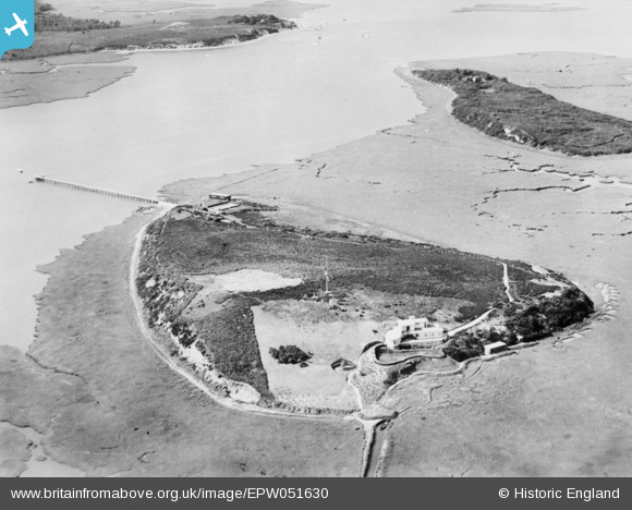
EPW051630 ENGLAND (1936). The island, Round Island, 1936. This image has been produced from a copy-negative.
© Copyright OpenStreetMap contributors and licensed by the OpenStreetMap Foundation. 2025. Cartography is licensed as CC BY-SA.
Nearby Images (3)
EPW051630

EPW051633

EPW051628

Details
| Title | [EPW051630] The island, Round Island, 1936. This image has been produced from a copy-negative. |
| Reference | EPW051630 |
| Date | August-1936 |
| Link | |
| Place name | ROUND ISLAND |
| Parish | CORFE CASTLE |
| District | |
| Country | ENGLAND |
| Easting / Northing | 398797, 87527 |
| Longitude / Latitude | -2.0170314204697, 50.686817065836 |
| National Grid Reference | SY988875 |
Pins
Be the first to add a comment to this image!