
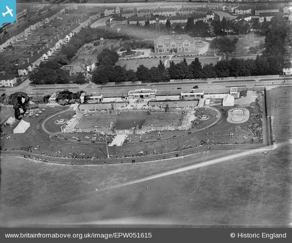
EPW051615 ENGLAND (1936). Purley Way Lido and the Waddon Water Works, Waddon, 1936
© Copyright OpenStreetMap contributors and licensed by the OpenStreetMap Foundation. 2026. Cartography is licensed as CC BY-SA.
Nearby Images (3)
EPW051615

EAW027962

EPW037827

Details
| Title | [EPW051615] Purley Way Lido and the Waddon Water Works, Waddon, 1936 |
| Reference | EPW051615 |
| Date | August-1936 |
| Link | |
| Place name | WADDON |
| Parish | |
| District | |
| Country | ENGLAND |
| Easting / Northing | 531443, 163794 |
| Longitude / Latitude | -0.11198175201683, 51.357491361909 |
| National Grid Reference | TQ314638 |
Pins

Tony74 |
Tuesday 14th of October 2014 05:16:08 PM | |
|
Johnners |
Tuesday 1st of October 2013 11:46:13 AM | |
I remember that tower as classic deco, not sure if it is still there, but it was in the 80's when the site was a garden centre. It made a strange juxtaposition. I do remember swimming there once in the 70's. |
BruceR |
Wednesday 13th of November 2013 10:26:59 PM |