
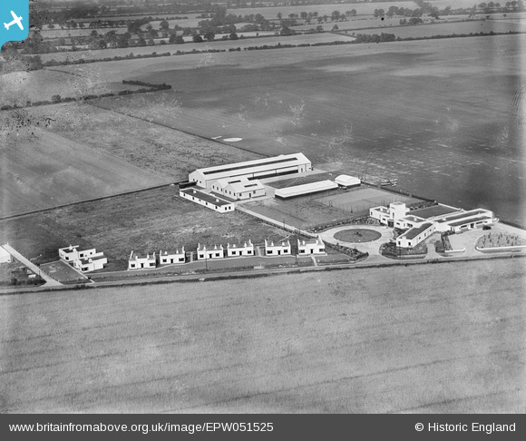
EPW051525 ENGLAND (1936). Hangars and buildings at Sywell Aerodrome, Sywell, 1936
© Copyright OpenStreetMap contributors and licensed by the OpenStreetMap Foundation. 2026. Cartography is licensed as CC BY-SA.
Nearby Images (4)
EPW051525

EPW051526

EPW051527

EPW045586

Details
| Title | [EPW051525] Hangars and buildings at Sywell Aerodrome, Sywell, 1936 |
| Reference | EPW051525 |
| Date | August-1936 |
| Link | |
| Place name | SYWELL |
| Parish | SYWELL |
| District | |
| Country | ENGLAND |
| Easting / Northing | 482567, 267647 |
| Longitude / Latitude | -0.78902646163413, 52.300342010031 |
| National Grid Reference | SP826676 |
Pins
Be the first to add a comment to this image!