
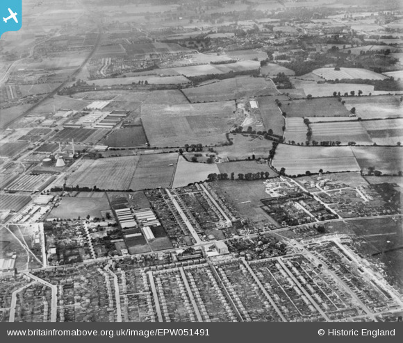
EPW051491 ENGLAND (1936). Farnham Royal Nurseries Ltd, the Slough Trading Estate, Furnival Avenue and environs, Slough, 1936. This image has been produced from a copy-negative.
© Copyright OpenStreetMap contributors and licensed by the OpenStreetMap Foundation. 2026. Cartography is licensed as CC BY-SA.
Nearby Images (5)
EPW051491

 0°
0m
0°
0m
EPW051475
 24°
12m
24°
12m
EPW051473
 171°
49m
171°
49m
EPW051486
 63°
167m
63°
167m
EPW051474
 111°
189m
111°
189m
Details
| Title | [EPW051491] Farnham Royal Nurseries Ltd, the Slough Trading Estate, Furnival Avenue and environs, Slough, 1936. This image has been produced from a copy-negative. |
| Reference | EPW051491 |
| Date | August-1936 |
| Link | |
| Place name | SLOUGH |
| Parish | |
| District | |
| Country | ENGLAND |
| Easting / Northing | 495450, 181919 |
| Longitude / Latitude | -0.62389834436745, 51.527625036544 |
| National Grid Reference | SU955819 |
Pins
 Burnham (Bucks) railway station. G.W.R. Burnham (Bucks) railway station. G.W.R. |

designking |
Friday 18th of September 2026 09:15:43 PM |
| A4....Bath Road. Heading West toward the top of the photo...Toward Taplow and Maidenhead. |
designking |
Friday 18th of September 2026 09:10:07 PM |
| Mars Ltd. |
designking |
Friday 18th of September 2026 09:08:12 PM |
| To become Priory Estate. |
designking |
Friday 18th of September 2026 09:06:20 PM |
| 5 Points crossroads. Named because 5 roads met here. Also crashed my Minivan into the bollards when coming down from Burnham High Street. c1965. |
designking |
Friday 18th of September 2026 09:05:03 PM |
| Th Haymill .....from which Haymill School takes its name |
designking |
Friday 18th of September 2026 08:58:35 PM |
| Reservoir (covered) |
Viper |
Monday 5th of February 2024 09:20:07 PM |
| pic taken from east this is George PH/Ambassador cinema corner |
dave43 |
Friday 2nd of January 2015 09:26:48 PM |
| slough estate power station |
dave43 |
Friday 2nd of January 2015 09:24:39 PM |