
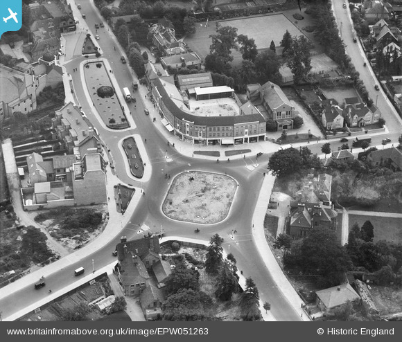
EPW051263 ENGLAND (1936). Faircross House and roundabout at the junction of High Street and Rickmansworth Road, Watford, 1936
© Copyright OpenStreetMap contributors and licensed by the OpenStreetMap Foundation. 2026. Cartography is licensed as CC BY-SA.
Nearby Images (12)
EPW051263

EPW051262

EPW051261

EPW051264

EPW051576

EPW051578

EPW051266

EPW051268

EPW051267

EAW018528

EPW037383

EPW040466

Details
| Title | [EPW051263] Faircross House and roundabout at the junction of High Street and Rickmansworth Road, Watford, 1936 |
| Reference | EPW051263 |
| Date | July-1936 |
| Link | |
| Place name | WATFORD |
| Parish | |
| District | |
| Country | ENGLAND |
| Easting / Northing | 510618, 196816 |
| Longitude / Latitude | -0.40060944127829, 51.658764125607 |
| National Grid Reference | TQ106968 |
Pins
Be the first to add a comment to this image!