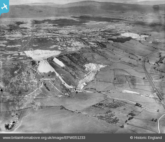
EPW051233 ENGLAND (1936). Ribblesdale Lime Works and surrounding quarries, Horton in Ribblesdale, from the south, 1936
© Copyright OpenStreetMap contributors and licensed by the OpenStreetMap Foundation. 2026. Cartography is licensed as CC BY-SA.
Details
| Title | [EPW051233] Ribblesdale Lime Works and surrounding quarries, Horton in Ribblesdale, from the south, 1936 |
| Reference | EPW051233 |
| Date | July-1936 |
| Link | |
| Place name | HORTON IN RIBBLESDALE |
| Parish | HORTON IN RIBBLESDALE |
| District | |
| Country | ENGLAND |
| Easting / Northing | 380502, 469903 |
| Longitude / Latitude | -2.2983741130673, 54.124439875334 |
| National Grid Reference | SD805699 |
Pins
User Comment Contributions
These two quarries, limestone- Foredale Quarry, and "granite" (properly Silurian slate) Arcow quarry were owned by Settle Limes Ltd. Arcow quarry was started in 1929 |

Tyson |
Friday 6th of May 2016 10:17:03 PM |


![[EPW051233] Ribblesdale Lime Works and surrounding quarries, Horton in Ribblesdale, from the south, 1936](http://britainfromabove.org.uk/sites/all/libraries/aerofilms-images/public/100x100/EPW/051/EPW051233.jpg)
![[EPW051231] Ribblesdale Lime Works, Horton in Ribblesdale, 1936](http://britainfromabove.org.uk/sites/all/libraries/aerofilms-images/public/100x100/EPW/051/EPW051231.jpg)
![[EAW024199] Foredale and Arcow Quarries, Foredale, from the south-east, 1949](http://britainfromabove.org.uk/sites/all/libraries/aerofilms-images/public/100x100/EAW/024/EAW024199.jpg)
![[EPW051235] Ribblesdale Lime Works and surrounding quarries, Horton in Ribblesdale, from the south-east, 1936. This image has been produced from a damaged negative.](http://britainfromabove.org.uk/sites/all/libraries/aerofilms-images/public/100x100/EPW/051/EPW051235.jpg)