
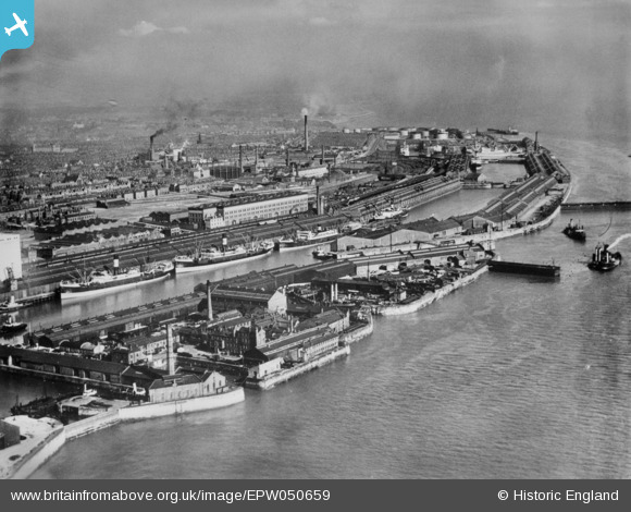
EPW050659 ENGLAND (1936). Brunswick, Toxteth and Harrington Docks, Liverpool, from the north-west, 1936. This image has been produced from a copy-negative.
© Copyright OpenStreetMap contributors and licensed by the OpenStreetMap Foundation. 2026. Cartography is licensed as CC BY-SA.
Nearby Images (6)
EPW050659

EPW018904

EAW399274

EPR000321

EPW018909

EPW050660

Details
| Title | [EPW050659] Brunswick, Toxteth and Harrington Docks, Liverpool, from the north-west, 1936. This image has been produced from a copy-negative. |
| Reference | EPW050659 |
| Date | June-1936 |
| Link | |
| Place name | LIVERPOOL |
| Parish | |
| District | |
| Country | ENGLAND |
| Easting / Northing | 334499, 388355 |
| Longitude / Latitude | -2.984972956506, 53.387705894011 |
| National Grid Reference | SJ345884 |
Pins
Be the first to add a comment to this image!