
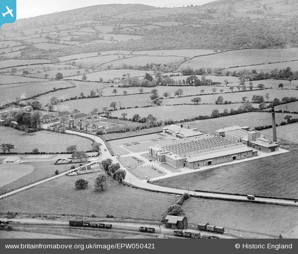
EPW050421 ENGLAND (1936). The Blue Bird Toffee Factory on Bromsgrove Road and surrounding countryside, Hunnington, from the north-east, 1936
© Copyright OpenStreetMap contributors and licensed by the OpenStreetMap Foundation. 2026. Cartography is licensed as CC BY-SA.
Nearby Images (14)
EPW050421

EPW050424

EPW050425

EPW050422

EPW050423

EAW015310

EAW015311

EAW015312

EPW050420

EAW015315

EAW015316

EAW015313

EPW050419

EAW015314

Details
| Title | [EPW050421] The Blue Bird Toffee Factory on Bromsgrove Road and surrounding countryside, Hunnington, from the north-east, 1936 |
| Reference | EPW050421 |
| Date | June-1936 |
| Link | |
| Place name | HUNNINGTON |
| Parish | HUNNINGTON |
| District | |
| Country | ENGLAND |
| Easting / Northing | 396670, 281395 |
| Longitude / Latitude | -2.0489820711349, 52.430150403757 |
| National Grid Reference | SO967814 |
Pins

PURCELL |
Sunday 17th of November 2013 01:53:26 PM |