
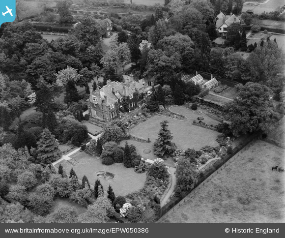
EPW050386 ENGLAND (1936). The Spinneys, Rothley, 1936
© Copyright OpenStreetMap contributors and licensed by the OpenStreetMap Foundation. 2026. Cartography is licensed as CC BY-SA.
Nearby Images (15)
EPW050386

EPW050384

EPW050387

EPW050385

EPW050383

EAW045946

EPW050380

EPW050381

EPW050382

EPW050379

EAW045947

EAW045944

EAW045949

EAW045948

EAW045945

Details
| Title | [EPW050386] The Spinneys, Rothley, 1936 |
| Reference | EPW050386 |
| Date | June-1936 |
| Link | |
| Place name | ROTHLEY |
| Parish | ROTHLEY |
| District | |
| Country | ENGLAND |
| Easting / Northing | 457359, 312572 |
| Longitude / Latitude | -1.1509412267351, 52.707428997293 |
| National Grid Reference | SK574126 |
Pins
Be the first to add a comment to this image!