
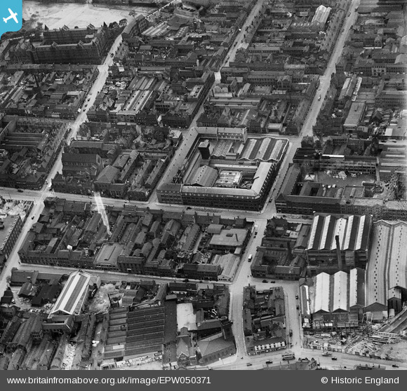
EPW050371 ENGLAND (1936). The A J Harrison Ltd Brass Foundry on Bradford Street and environs, Birmingham, 1936
© Copyright OpenStreetMap contributors and licensed by the OpenStreetMap Foundation. 2026. Cartography is licensed as CC BY-SA.
Nearby Images (16)
EPW050371

EPW050089

EPW050372

EPW050370

EPW050091

EPW050088

EPW050087

EPW053102

EPW053097

EPW005841

EPW037036

EPW037037

EPW037035

EPW037038

EPW037039

EPW037040

Details
| Title | [EPW050371] The A J Harrison Ltd Brass Foundry on Bradford Street and environs, Birmingham, 1936 |
| Reference | EPW050371 |
| Date | June-1936 |
| Link | |
| Place name | BIRMINGHAM |
| Parish | |
| District | |
| Country | ENGLAND |
| Easting / Northing | 407861, 286123 |
| Longitude / Latitude | -1.8842586735171, 52.472613622792 |
| National Grid Reference | SP079861 |
Pins
Be the first to add a comment to this image!