
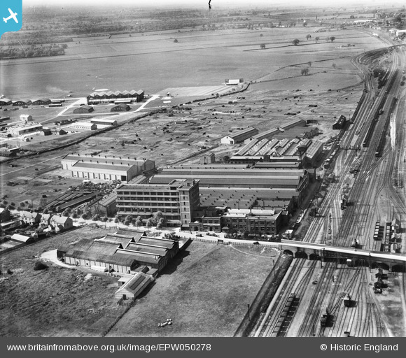
EPW050278 ENGLAND (1936). The Westwood Engineering Works and the Peterborough II (Westwood) airfield, Peterborough, 1936
© Copyright OpenStreetMap contributors and licensed by the OpenStreetMap Foundation. 2026. Cartography is licensed as CC BY-SA.
Nearby Images (25)
EPW050278
 airfield, Peterborough, 1936")
EPW050275
 airfield, Peterborough, 1936")
EPW050281
 airfield, Peterborough, 1936")
EPW050274
 airfield, Peterborough, 1936")
EAW005685

EPW009768

EPW050277

EAW005686

EPW050279
 airfield, Peterborough, 1936")
EAW005684

EPW009765

EPW009769

EPW009770

EPW016324

EPW016323

EPW009766

EAW005683

EPW009767

EAW005677

EAW005681

EAW005682

EAW005679

EAW005678

EAW005680

EPW050280
 airfield, Peterborough, from the south-east, 1936")
Details
| Title | [EPW050278] The Westwood Engineering Works and the Peterborough II (Westwood) airfield, Peterborough, 1936 |
| Reference | EPW050278 |
| Date | May-1936 |
| Link | |
| Place name | PETERBOROUGH |
| Parish | |
| District | |
| Country | ENGLAND |
| Easting / Northing | 518067, 299939 |
| Longitude / Latitude | -0.25716641469225, 52.584064202055 |
| National Grid Reference | TL181999 |
Pins
Be the first to add a comment to this image!