
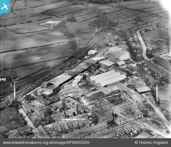
EPW050259 ENGLAND (1936). The Midland Woodworking Saw Mill, Melton Mowbray, 1936. This image was marked by Aerofilms Ltd for photo editing.
© Copyright OpenStreetMap contributors and licensed by the OpenStreetMap Foundation. 2026. Cartography is licensed as CC BY-SA.
Nearby Images (20)
EPW050259

EPW050260

EPW050261

EPW038041

EPW050263

EPW050258

EPW037857

EPW038044

EPW038043

EPW037861

EPW037858

EPW038042

EPW037859

EPW037856

EPW050257

EPW037860

EPW038045

EPW050264

EPW050262

EPW050256

Details
| Title | [EPW050259] The Midland Woodworking Saw Mill, Melton Mowbray, 1936. This image was marked by Aerofilms Ltd for photo editing. |
| Reference | EPW050259 |
| Date | May-1936 |
| Link | |
| Place name | MELTON MOWBRAY |
| Parish | |
| District | |
| Country | ENGLAND |
| Easting / Northing | 475662, 319625 |
| Longitude / Latitude | -0.87843364515052, 52.768578369754 |
| National Grid Reference | SK757196 |
Pins
Be the first to add a comment to this image!