
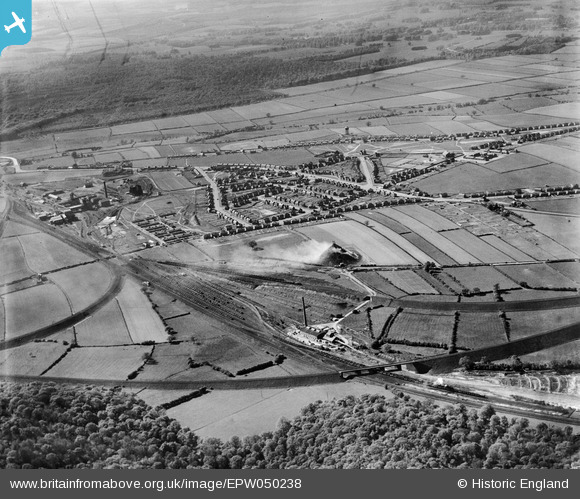
EPW050238 ENGLAND (1936). The Ollerton Brick Works, housing at New Ollerton and surrounding countryside, Ollerton, 1936
© Copyright OpenStreetMap contributors and licensed by the OpenStreetMap Foundation. 2026. Cartography is licensed as CC BY-SA.
Nearby Images (5)
EPW050238

EPW050239

EPW050230

EPW050232

EPW050234

Details
| Title | [EPW050238] The Ollerton Brick Works, housing at New Ollerton and surrounding countryside, Ollerton, 1936 |
| Reference | EPW050238 |
| Date | May-1936 |
| Link | |
| Place name | OLLERTON |
| Parish | OLLERTON AND BOUGHTON |
| District | |
| Country | ENGLAND |
| Easting / Northing | 466901, 367605 |
| Longitude / Latitude | -0.99835101208833, 53.201021260291 |
| National Grid Reference | SK669676 |
Pins

GrahamT |
Monday 29th of September 2014 10:20:40 PM | |
|
MB |
Wednesday 30th of October 2013 11:08:25 AM | |
|
MB |
Wednesday 30th of October 2013 10:59:35 AM | |
|
Chris |
Tuesday 2nd of July 2013 04:22:22 PM | |
|
Chris |
Tuesday 2nd of July 2013 04:20:38 PM | |
|
Chris |
Tuesday 2nd of July 2013 04:19:44 PM | |
|
Chris |
Tuesday 2nd of July 2013 04:18:17 PM | |
|
Chris |
Tuesday 2nd of July 2013 04:17:39 PM | |
|
Chris |
Tuesday 2nd of July 2013 04:16:26 PM | |
|
Chris |
Tuesday 2nd of July 2013 04:11:44 PM | |

Dylan Moore |
Saturday 22nd of June 2013 12:29:07 PM |
User Comment Contributions
Ollerton Colliery to the left of this image. A history of the site is provided here: www.ollertonandarea.org.uk/our-heritage/heritage-articles/ollerton-colliery-a-brief-history |
MB |
Wednesday 30th of October 2013 11:09:33 AM |