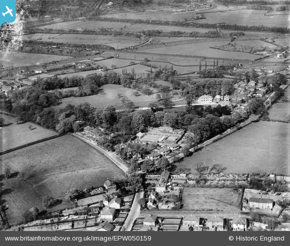
EPW050159 ENGLAND (1936). Marshall's Brow, Penwortham Hall and environs, Middleforth Green, 1936
© Copyright OpenStreetMap contributors and licensed by the OpenStreetMap Foundation. 2024. Cartography is licensed as CC BY-SA.
Nearby Images (6)
Details
| Title | [EPW050159] Marshall's Brow, Penwortham Hall and environs, Middleforth Green, 1936 |
| Reference | EPW050159 |
| Date | May-1936 |
| Link | |
| Place name | MIDDLEFORTH GREEN |
| Parish | PENWORTHAM |
| District | |
| Country | ENGLAND |
| Easting / Northing | 353136, 427238 |
| Longitude / Latitude | -2.7105805006541, 53.739195654719 |
| National Grid Reference | SD531272 |


![[EPW050159] Marshall's Brow, Penwortham Hall and environs, Middleforth Green, 1936](http://britainfromabove.org.uk/sites/all/libraries/aerofilms-images/public/100x100/EPW/050/EPW050159.jpg)
![[EPW050162] Penwortham Hall, Park Lane under construction and environs, Middleforth Green, 1936](http://britainfromabove.org.uk/sites/all/libraries/aerofilms-images/public/100x100/EPW/050/EPW050162.jpg)
![[EPW050161] Penwortham Hall, Park Lane under construction and environs, Middleforth Green, from the north-west, 1936](http://britainfromabove.org.uk/sites/all/libraries/aerofilms-images/public/100x100/EPW/050/EPW050161.jpg)
![[EPW050160] Penwortham Hall, Park Lane under construction and environs, Middleforth Green, 1936](http://britainfromabove.org.uk/sites/all/libraries/aerofilms-images/public/100x100/EPW/050/EPW050160.jpg)
![[EPW050163] Penwortham Hall, Park Lane under construction and environs, Middleforth Green, from the south, 1936](http://britainfromabove.org.uk/sites/all/libraries/aerofilms-images/public/100x100/EPW/050/EPW050163.jpg)
![[EPW050164] Penwortham Hall, Park Lane under construction and environs, Middleforth Green, 1936](http://britainfromabove.org.uk/sites/all/libraries/aerofilms-images/public/100x100/EPW/050/EPW050164.jpg)
