
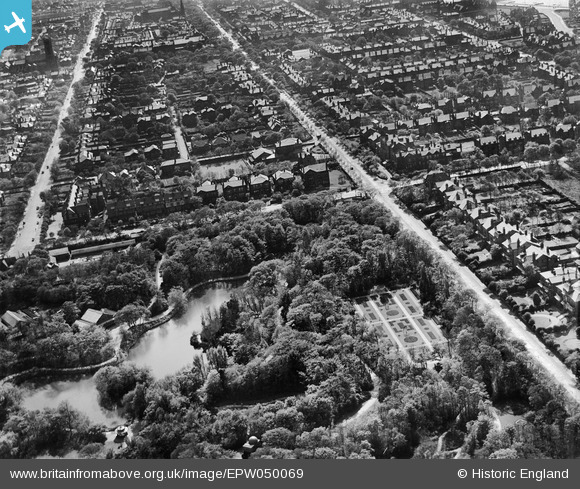
EPW050069 ENGLAND (1936). Hesketh Park, Albert Road (A565) and the surrounding residential area, Southport, 1936
© Copyright OpenStreetMap contributors and licensed by the OpenStreetMap Foundation. 2025. Cartography is licensed as CC BY-SA.
Nearby Images (11)
EPW050069
 and the surrounding residential area, Southport, 1936")
EPW050076

EPW050071

EPW050068

EPW050075

EPW050070

EPW050074

EPW050072

EPW050073

EPW050077

EPW050067
 and the surrounding residential area, Southport, from the north-east, 1936")
Details
| Title | [EPW050069] Hesketh Park, Albert Road (A565) and the surrounding residential area, Southport, 1936 |
| Reference | EPW050069 |
| Date | May-1936 |
| Link | |
| Place name | SOUTHPORT |
| Parish | |
| District | |
| Country | ENGLAND |
| Easting / Northing | 334629, 418157 |
| Longitude / Latitude | -2.9892395753525, 53.655585255875 |
| National Grid Reference | SD346182 |
Pins
Be the first to add a comment to this image!