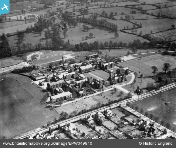
EPW049840 ENGLAND (1936). The Royal Masonic School for Boys, Bushey, 1936. This image has been produced from a print.
© Copyright OpenStreetMap contributors and licensed by the OpenStreetMap Foundation. 2025. Cartography is licensed as CC BY-SA.
Nearby Images (5)
Details
| Title | [EPW049840] The Royal Masonic School for Boys, Bushey, 1936. This image has been produced from a print. |
| Reference | EPW049840 |
| Date | April-1936 |
| Link | |
| Place name | BUSHEY |
| Parish | |
| District | |
| Country | ENGLAND |
| Easting / Northing | 512912, 196165 |
| Longitude / Latitude | -0.36766586244525, 51.652456276871 |
| National Grid Reference | TQ129962 |


![[EPW049840] The Royal Masonic School for Boys, Bushey, 1936. This image has been produced from a print.](http://britainfromabove.org.uk/sites/all/libraries/aerofilms-images/public/100x100/EPW/049/EPW049840.jpg)
![[EPW035170] The Royal Masonic School for Boys, Bushey, 1931](http://britainfromabove.org.uk/sites/all/libraries/aerofilms-images/public/100x100/EPW/035/EPW035170.jpg)
![[EPW035169] The Royal Masonic School for Boys, Bushey, 1931](http://britainfromabove.org.uk/sites/all/libraries/aerofilms-images/public/100x100/EPW/035/EPW035169.jpg)
![[EPW035171] The Royal Masonic School for Boys, Bushey, 1931](http://britainfromabove.org.uk/sites/all/libraries/aerofilms-images/public/100x100/EPW/035/EPW035171.jpg)
![[EAW018530] The Royal Masonic School and environs, Bushey, from the south, 1948. This image has been produced from a print.](http://britainfromabove.org.uk/sites/all/libraries/aerofilms-images/public/100x100/EAW/018/EAW018530.jpg)
