
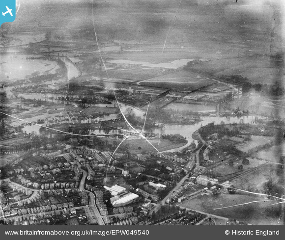
EPW049540 ENGLAND (1936). Flooding around the Wey Navigation and the River Thames, Weybridge, from the south-east, 1936. This image has been produced from a damaged negative.
© Copyright OpenStreetMap contributors and licensed by the OpenStreetMap Foundation. 2026. Cartography is licensed as CC BY-SA.
Nearby Images (2)
EPW049540

EPW023384

Details
| Title | [EPW049540] Flooding around the Wey Navigation and the River Thames, Weybridge, from the south-east, 1936. This image has been produced from a damaged negative. |
| Reference | EPW049540 |
| Date | January-1936 |
| Link | |
| Place name | WEYBRIDGE |
| Parish | |
| District | |
| Country | ENGLAND |
| Easting / Northing | 507539, 165315 |
| Longitude / Latitude | -0.45472433413232, 51.376193467884 |
| National Grid Reference | TQ075653 |
Pins
Be the first to add a comment to this image!