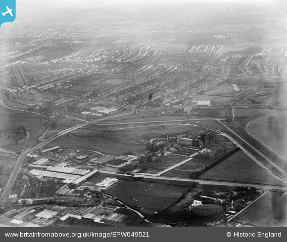
EPW049521 ENGLAND (1935). The Angel Factory Colony and environs, Upper Edmonton, from the west, 1935
© Copyright OpenStreetMap contributors and licensed by the OpenStreetMap Foundation. 2026. Cartography is licensed as CC BY-SA.
Nearby Images (7)
Details
| Title | [EPW049521] The Angel Factory Colony and environs, Upper Edmonton, from the west, 1935 |
| Reference | EPW049521 |
| Date | December-1935 |
| Link | |
| Place name | UPPER EDMONTON |
| Parish | |
| District | |
| Country | ENGLAND |
| Easting / Northing | 535763, 191991 |
| Longitude / Latitude | -0.039125694618385, 51.609889915976 |
| National Grid Reference | TQ358920 |
Pins
Be the first to add a comment to this image!


![[EPW049521] The Angel Factory Colony and environs, Upper Edmonton, from the west, 1935](http://britainfromabove.org.uk/sites/all/libraries/aerofilms-images/public/100x100/EPW/049/EPW049521.jpg)
![[EPW049728] The Glover and Main Gothic Works (Gas Meters and Stoves) and other factories, Edmonton, 1936](http://britainfromabove.org.uk/sites/all/libraries/aerofilms-images/public/100x100/EPW/049/EPW049728.jpg)
![[EPW048900] The Gothic Gas Meters and Stove Works, the Sparklet Works and the site of the William Girling Reservoir, Upper Edmonton, from the south, 1935](http://britainfromabove.org.uk/sites/all/libraries/aerofilms-images/public/100x100/EPW/048/EPW048900.jpg)
![[EPW005591] The Angel Road Linoleum Works, Edmonton, 1921](http://britainfromabove.org.uk/sites/all/libraries/aerofilms-images/public/100x100/EPW/005/EPW005591.jpg)
![[EPW052272] The Angel Factory Colony, Edmonton, 1936. This image has been produced from a damaged negative.](http://britainfromabove.org.uk/sites/all/libraries/aerofilms-images/public/100x100/EPW/052/EPW052272.jpg)
![[EPW042085] Bennett Teff Ltd and the Angel Factory Colony, Edmonton, 1933](http://britainfromabove.org.uk/sites/all/libraries/aerofilms-images/public/100x100/EPW/042/EPW042085.jpg)
![[EPW042086] Bennett Teff Ltd and the Angel Factory Colony, Edmonton, 1933](http://britainfromabove.org.uk/sites/all/libraries/aerofilms-images/public/100x100/EPW/042/EPW042086.jpg)