
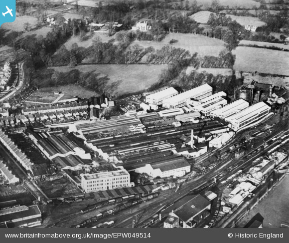
EPW049514 ENGLAND (1935). The Westinghouse Brake and Signal Works, Chippenham, 1935. This image has been produced from a copy-negative.
© Copyright OpenStreetMap contributors and licensed by the OpenStreetMap Foundation. 2026. Cartography is licensed as CC BY-SA.
Nearby Images (19)
EPW049514

EPW058969

EPW058970

EPW058967

EPW058971

EPW058968

EAW050139

EPW058966

EAW050137

EPW057299

EAW050136

EPW057297

EAW050138

EAW050142

EPW057296

EAW050135

EAW050140

EAW050141

EPW057298

Details
| Title | [EPW049514] The Westinghouse Brake and Signal Works, Chippenham, 1935. This image has been produced from a copy-negative. |
| Reference | EPW049514 |
| Date | November-1935 |
| Link | |
| Place name | CHIPPENHAM |
| Parish | CHIPPENHAM |
| District | |
| Country | ENGLAND |
| Easting / Northing | 392291, 174059 |
| Longitude / Latitude | -2.1109858971118, 51.464961911921 |
| National Grid Reference | ST923741 |
Pins
Be the first to add a comment to this image!