
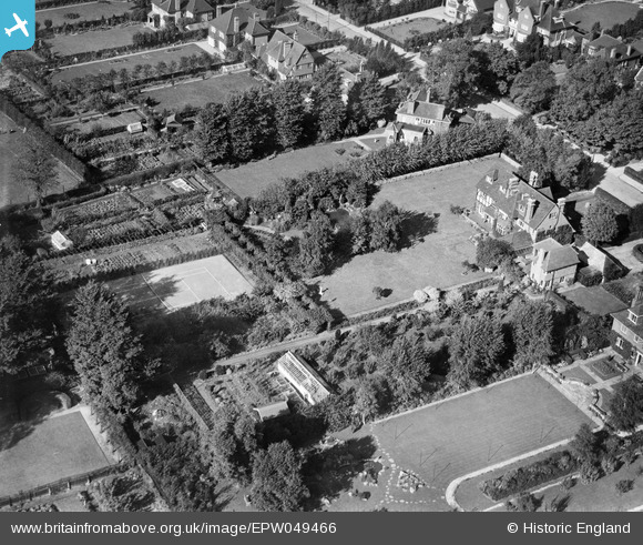
EPW049466 ENGLAND (1935). Frithwood Avenue, Northwood, 1935
© Copyright OpenStreetMap contributors and licensed by the OpenStreetMap Foundation. 2026. Cartography is licensed as CC BY-SA.
Nearby Images (5)
EPW049466

EPW049463

EPW049464

EPW049462

EPW049465

Details
| Title | [EPW049466] Frithwood Avenue, Northwood, 1935 |
| Reference | EPW049466 |
| Date | October-1935 |
| Link | |
| Place name | NORTHWOOD |
| Parish | |
| District | |
| Country | ENGLAND |
| Easting / Northing | 509590, 191856 |
| Longitude / Latitude | -0.41702014348022, 51.614380812982 |
| National Grid Reference | TQ096919 |
Pins

Class31 |
Wednesday 6th of November 2013 06:00:32 PM | |
...we'll update the catalogue and post the new data here in due course. Yours, Katy Britain from Above Cataloguing Team Leader |
Katy Whitaker |
Wednesday 8th of January 2014 10:57:30 AM |
User Comment Contributions
See also EPW049462, EPW049463 and EPW049464 (& give Maurice credit for spotting same). |

BigglesH |
Monday 1st of July 2013 02:58:02 AM |