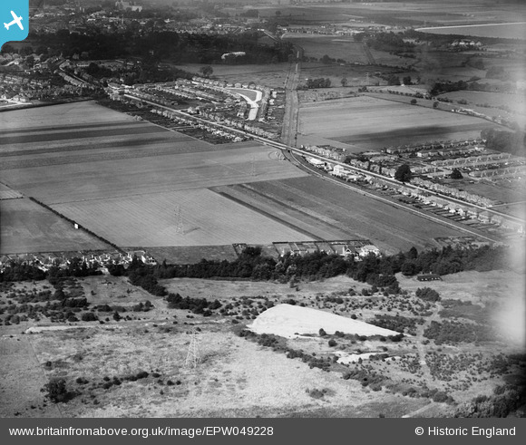
EPW049228 ENGLAND (1935). Knowle Green, Laleham, 1935
© Copyright OpenStreetMap contributors and licensed by the OpenStreetMap Foundation. 2026. Cartography is licensed as CC BY-SA.
Details
| Title | [EPW049228] Knowle Green, Laleham, 1935 |
| Reference | EPW049228 |
| Date | September-1935 |
| Link | |
| Place name | LALEHAM |
| Parish | |
| District | |
| Country | ENGLAND |
| Easting / Northing | 505803, 170570 |
| Longitude / Latitude | -0.47809284979446, 51.423759479161 |
| National Grid Reference | TQ058706 |


![[EPW049228] Knowle Green, Laleham, 1935](http://britainfromabove.org.uk/sites/all/libraries/aerofilms-images/public/100x100/EPW/049/EPW049228.jpg)
![[EPW049227] Knowle Green, Laleham, 1935](http://britainfromabove.org.uk/sites/all/libraries/aerofilms-images/public/100x100/EPW/049/EPW049227.jpg)
![[EPW049222] Knowle Green and the view towards Staines, Laleham, from the south-east, 1935](http://britainfromabove.org.uk/sites/all/libraries/aerofilms-images/public/100x100/EPW/049/EPW049222.jpg)

