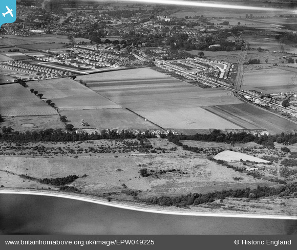
EPW049225 ENGLAND (1935). Knowle Green and the view towards Staines, Laleham, from the south-east, 1935
© Copyright OpenStreetMap contributors and licensed by the OpenStreetMap Foundation. 2026. Cartography is licensed as CC BY-SA.
Details
| Title | [EPW049225] Knowle Green and the view towards Staines, Laleham, from the south-east, 1935 |
| Reference | EPW049225 |
| Date | September-1935 |
| Link | |
| Place name | LALEHAM |
| Parish | |
| District | |
| Country | ENGLAND |
| Easting / Northing | 506113, 170223 |
| Longitude / Latitude | -0.47373932913252, 51.420582178791 |
| National Grid Reference | TQ061702 |
Pins

Billy121 |
Thursday 17th of July 2014 11:22:13 AM | |

bumblee |
Friday 1st of November 2013 04:51:06 PM | |

bumblee |
Friday 1st of November 2013 04:47:58 PM | |

bumblee |
Friday 1st of November 2013 04:47:16 PM | |

Maurice |
Thursday 27th of December 2012 09:07:40 AM | |

Maurice |
Thursday 27th of December 2012 09:05:02 AM |


![[EPW049225] Knowle Green and the view towards Staines, Laleham, from the south-east, 1935](http://britainfromabove.org.uk/sites/all/libraries/aerofilms-images/public/100x100/EPW/049/EPW049225.jpg)
![[EPW049226] Knowle Green and the view towards Staines, Laleham, from the south-east, 1935](http://britainfromabove.org.uk/sites/all/libraries/aerofilms-images/public/100x100/EPW/049/EPW049226.jpg)
![[EPW049223] Knowle Green and the view towards Staines, Laleham, from the south-east, 1935](http://britainfromabove.org.uk/sites/all/libraries/aerofilms-images/public/100x100/EPW/049/EPW049223.jpg)