
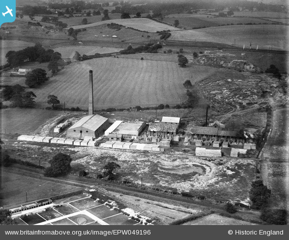
EPW049196 ENGLAND (1935). Durham Brick and Tile Co Ltd Claypath Works, Durham, 1935
© Copyright OpenStreetMap contributors and licensed by the OpenStreetMap Foundation. 2026. Cartography is licensed as CC BY-SA.
Nearby Images (7)
EPW049196

EPW049195

EPW049200

EPW049199

EPW049197

EPW049198

EPW049194

Details
| Title | [EPW049196] Durham Brick and Tile Co Ltd Claypath Works, Durham, 1935 |
| Reference | EPW049196 |
| Date | September-1935 |
| Link | |
| Place name | DURHAM |
| Parish | |
| District | |
| Country | ENGLAND |
| Easting / Northing | 427603, 543310 |
| Longitude / Latitude | -1.5707525168966, 54.783834749 |
| National Grid Reference | NZ276433 |
Pins

Dylan Moore |
Saturday 22nd of June 2013 12:38:57 PM | |

MB |
Friday 19th of April 2013 01:55:29 PM | |
|
MB |
Friday 19th of April 2013 01:52:17 PM | |
|
MB |
Friday 19th of April 2013 01:50:57 PM | |
|
MB |
Friday 19th of April 2013 01:50:20 PM | |
|
MB |
Friday 19th of April 2013 01:49:50 PM | |
|
MB |
Friday 19th of April 2013 01:49:18 PM | |
|
MB |
Friday 19th of April 2013 01:48:44 PM |
User Comment Contributions
The brickworks did not exist in 1919. So - a relatively recent development |
MB |
Friday 19th of April 2013 01:56:24 PM |