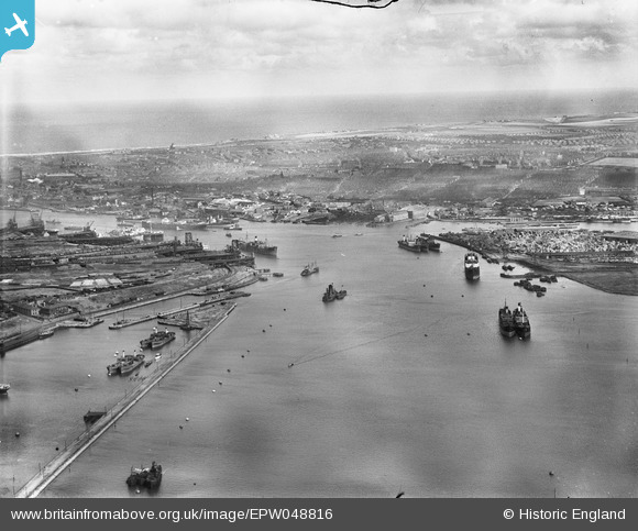
EPW048816 ENGLAND (1935). The River Tyne at the entrance to Northumberland Dock looking across South Shields to the coast, Jarrow, from the west, 1935
© Copyright OpenStreetMap contributors and licensed by the OpenStreetMap Foundation. 2025. Cartography is licensed as CC BY-SA.
Nearby Images (2)
EPW048816

EPW025056

Details
| Title | [EPW048816] The River Tyne at the entrance to Northumberland Dock looking across South Shields to the coast, Jarrow, from the west, 1935 |
| Reference | EPW048816 |
| Date | August-1935 |
| Link | |
| Place name | JARROW |
| Parish | |
| District | |
| Country | ENGLAND |
| Easting / Northing | 434588, 565937 |
| Longitude / Latitude | -1.4594197378703, 54.986750550801 |
| National Grid Reference | NZ346659 |
Pins
 N Dunn |
Wednesday 25th of September 2013 06:34:21 PM |