
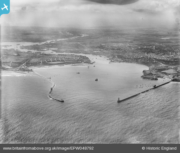
EPW048792 ENGLAND (1935). The North Pier, South Pier and entrance to the River Tyne, Tynemouth, from the east, 1935
© Copyright OpenStreetMap contributors and licensed by the OpenStreetMap Foundation. 2026. Cartography is licensed as CC BY-SA.
Nearby Images (2)
EPW048792

 0°
0m
0°
0m
EPW048237
 249°
116m
249°
116m
Details
| Title | [EPW048792] The North Pier, South Pier and entrance to the River Tyne, Tynemouth, from the east, 1935 |
| Reference | EPW048792 |
| Date | August-1935 |
| Link | |
| Place name | TYNEMOUTH |
| Parish | |
| District | |
| Country | ENGLAND |
| Easting / Northing | 438305, 568838 |
| Longitude / Latitude | -1.4009413237306, 55.01254904875 |
| National Grid Reference | NZ383688 |
Pins
Be the first to add a comment to this image!