
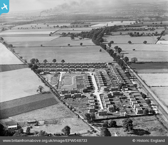
EPW048733 ENGLAND (1935). New housing under construction beside the Great North Road, Bentley, from the south-east, 1935
© Copyright OpenStreetMap contributors and licensed by the OpenStreetMap Foundation. 2026. Cartography is licensed as CC BY-SA.
Nearby Images (8)
EPW048733

EPW048734

EPW048739

EPW048737

EPW048738

EPW048736

EPW048732

EPW048740

Details
| Title | [EPW048733] New housing under construction beside the Great North Road, Bentley, from the south-east, 1935 |
| Reference | EPW048733 |
| Date | July-1935 |
| Link | |
| Place name | BENTLEY |
| Parish | |
| District | |
| Country | ENGLAND |
| Easting / Northing | 455132, 405102 |
| Longitude / Latitude | -1.167993329458, 53.539421905516 |
| National Grid Reference | SE551051 |
Pins

tomar |
Tuesday 1st of October 2013 05:37:23 AM | |
The pathway from about the bottom centre up to the top left is the remains of a Roman road, known locally as the "Roman Rigg" It is still there today. In the 1940's the fields around the Rigg were cornfields. |
tomar |
Tuesday 8th of October 2013 08:44:49 PM |