
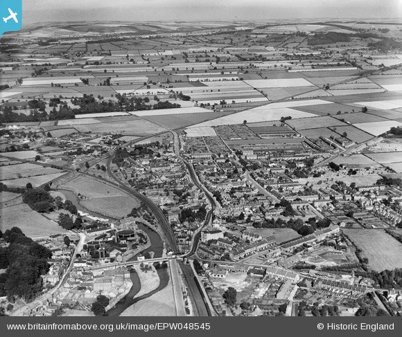
EPW048545 ENGLAND (1935). Malton Bridge, the town and surrounding countryside, Norton-on-Derwent, 1935
© Copyright OpenStreetMap contributors and licensed by the OpenStreetMap Foundation. 2026. Cartography is licensed as CC BY-SA.
Nearby Images (3)
EPW048545

EPW029537

EPW048555

Details
| Title | [EPW048545] Malton Bridge, the town and surrounding countryside, Norton-on-Derwent, 1935 |
| Reference | EPW048545 |
| Date | July-1935 |
| Link | |
| Place name | NORTON-ON-DERWENT |
| Parish | NORTON-ON-DERWENT |
| District | |
| Country | ENGLAND |
| Easting / Northing | 479232, 471400 |
| Longitude / Latitude | -0.78727612229158, 54.132157312629 |
| National Grid Reference | SE792714 |
Pins

Tony Kirby |
Friday 23rd of August 2019 07:50:18 PM | |
|
Tony Kirby |
Friday 23rd of August 2019 07:48:29 PM | |
|
DaveH |
Sunday 19th of February 2017 01:44:34 AM | |
|
AndyW |
Monday 21st of July 2014 11:57:07 AM | |
|
AndyW |
Monday 21st of July 2014 11:56:05 AM |