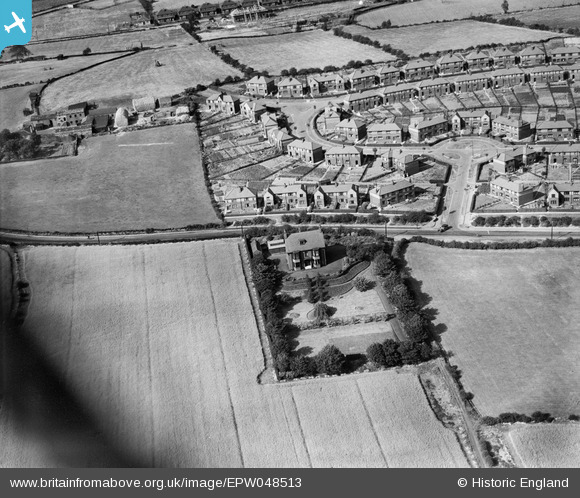
EPW048513 ENGLAND (1935). Brooklands House and the housing estate surrounding Canning Avenue, Alverthorpe, 1935
© Copyright OpenStreetMap contributors and licensed by the OpenStreetMap Foundation. 2024. Cartography is licensed as CC BY-SA.
Details
| Title | [EPW048513] Brooklands House and the housing estate surrounding Canning Avenue, Alverthorpe, 1935 |
| Reference | EPW048513 |
| Date | July-1935 |
| Link | |
| Place name | ALVERTHORPE |
| Parish | |
| District | |
| Country | ENGLAND |
| Easting / Northing | 430638, 421848 |
| Longitude / Latitude | -1.5359702840058, 53.691951886164 |
| National Grid Reference | SE306218 |
Pins
Be the first to add a comment to this image!


![[EPW048513] Brooklands House and the housing estate surrounding Canning Avenue, Alverthorpe, 1935](http://britainfromabove.org.uk/sites/all/libraries/aerofilms-images/public/100x100/EPW/048/EPW048513.jpg)
![[EPW048515] Brooklands House and the housing estate surrounding Canning Avenue, Alverthorpe, 1935](http://britainfromabove.org.uk/sites/all/libraries/aerofilms-images/public/100x100/EPW/048/EPW048515.jpg)