
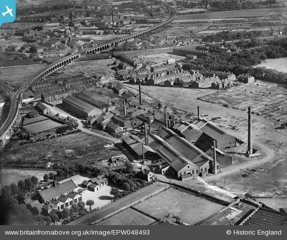
EPW048493 ENGLAND (1935). The British Ropes Ltd Works, Wakefield, 1935
© Copyright OpenStreetMap contributors and licensed by the OpenStreetMap Foundation. 2026. Cartography is licensed as CC BY-SA.
Nearby Images (8)
EPW048493

EPW048497

EPW048498

EPW048495

EPW048496

EPW048499

EPW048500

EPW048494

Details
| Title | [EPW048493] The British Ropes Ltd Works, Wakefield, 1935 |
| Reference | EPW048493 |
| Date | July-1935 |
| Link | |
| Place name | WAKEFIELD |
| Parish | |
| District | |
| Country | ENGLAND |
| Easting / Northing | 432892, 420198 |
| Longitude / Latitude | -1.5020085719094, 53.676983195787 |
| National Grid Reference | SE329202 |
Pins
Be the first to add a comment to this image!