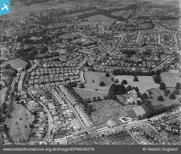
EPW048278 ENGLAND (1935). Northumberland House and the suburb of Henleaze, Eastfield, 1935
© Copyright OpenStreetMap contributors and licensed by the OpenStreetMap Foundation. 2025. Cartography is licensed as CC BY-SA.
Details
| Title | [EPW048278] Northumberland House and the suburb of Henleaze, Eastfield, 1935 |
| Reference | EPW048278 |
| Date | July-1935 |
| Link | |
| Place name | EASTFIELD |
| Parish | |
| District | |
| Country | ENGLAND |
| Easting / Northing | 357583, 176285 |
| Longitude / Latitude | -2.6109236622915, 51.483440699918 |
| National Grid Reference | ST576763 |
Pins
 Tpgrw |
Wednesday 19th of November 2014 03:22:13 PM | |
 Tpgrw |
Wednesday 19th of November 2014 03:20:47 PM | |
 Geoff |
Wednesday 27th of August 2014 03:12:22 PM | |
 Geoff |
Friday 1st of August 2014 04:28:18 PM | |
 Geoff |
Friday 1st of August 2014 04:26:04 PM | |
 Geoff |
Wednesday 30th of July 2014 04:01:32 PM | |
 Geoff |
Wednesday 30th of July 2014 04:00:57 PM |


![[EPW048278] Northumberland House and the suburb of Henleaze, Eastfield, 1935](http://britainfromabove.org.uk/sites/all/libraries/aerofilms-images/public/100x100/EPW/048/EPW048278.jpg)
![[EPW048277] Westbury Park and the suburb of Henleaze, Eastfield, 1935](http://britainfromabove.org.uk/sites/all/libraries/aerofilms-images/public/100x100/EPW/048/EPW048277.jpg)
![[EPW048276] The suburb of Henleaze, Eastfield, 1935](http://britainfromabove.org.uk/sites/all/libraries/aerofilms-images/public/100x100/EPW/048/EPW048276.jpg)