
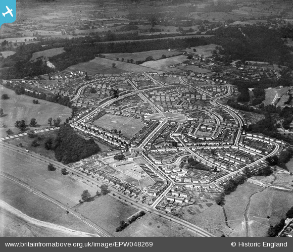
EPW048269 ENGLAND (1935). The residential area surrounding St Edyth's Road and Sylvan Way, Sea Mills, 1935
© Copyright OpenStreetMap contributors and licensed by the OpenStreetMap Foundation. 2025. Cartography is licensed as CC BY-SA.
Nearby Images (2)
EPW048269

EPW048270

Details
| Title | [EPW048269] The residential area surrounding St Edyth's Road and Sylvan Way, Sea Mills, 1935 |
| Reference | EPW048269 |
| Date | July-1935 |
| Link | |
| Place name | SEA MILLS |
| Parish | |
| District | |
| Country | ENGLAND |
| Easting / Northing | 355024, 176749 |
| Longitude / Latitude | -2.6478370942275, 51.487415197932 |
| National Grid Reference | ST550767 |
Pins

Geoff |
Tuesday 22nd of July 2014 04:02:58 PM | |
|
Geoff |
Tuesday 22nd of July 2014 04:02:30 PM | |
|
Geoff |
Tuesday 22nd of July 2014 04:00:52 PM | |
|
Geoff |
Tuesday 22nd of July 2014 03:56:48 PM | |
|
Geoff |
Tuesday 22nd of July 2014 03:56:08 PM | |
|
Geoff |
Tuesday 22nd of July 2014 03:49:06 PM |