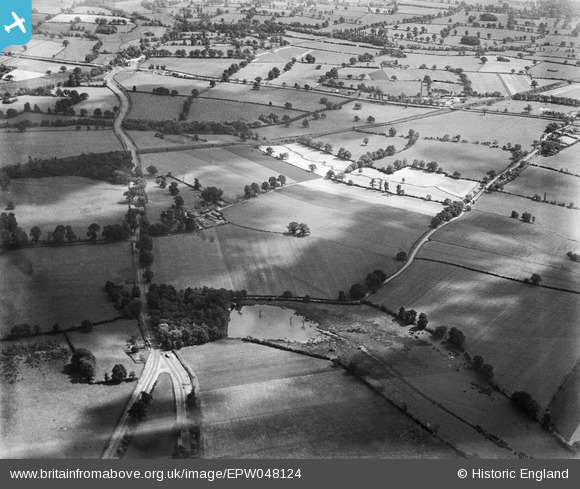
EPW048124 ENGLAND (1935). Denbigh Spinney, the Chester Road, Middle Bickenhill Lane and surrounding countryside, Middle Bickenhill, from the north-west, 1935
© Copyright OpenStreetMap contributors and licensed by the OpenStreetMap Foundation. 2024. Cartography is licensed as CC BY-SA.
Nearby Images (5)
Details
| Title | [EPW048124] Denbigh Spinney, the Chester Road, Middle Bickenhill Lane and surrounding countryside, Middle Bickenhill, from the north-west, 1935 |
| Reference | EPW048124 |
| Date | July-1935 |
| Link | |
| Place name | MIDDLE BICKENHILL |
| Parish | BICKENHILL |
| District | |
| Country | ENGLAND |
| Easting / Northing | 420412, 284175 |
| Longitude / Latitude | -1.699585355836, 52.45477422908 |
| National Grid Reference | SP204842 |
Pins
 speedwing |
Thursday 25th of June 2015 10:12:27 AM | |
 speedwing |
Thursday 25th of June 2015 09:56:16 AM | |
 speedwing |
Thursday 25th of June 2015 09:55:37 AM | |
 speedwing |
Thursday 25th of June 2015 09:53:15 AM |


![[EPW048124] Denbigh Spinney, the Chester Road, Middle Bickenhill Lane and surrounding countryside, Middle Bickenhill, from the north-west, 1935](http://britainfromabove.org.uk/sites/all/libraries/aerofilms-images/public/100x100/EPW/048/EPW048124.jpg)
![[EPW048126] Denbigh Spinney, Middle Bickenhill Lane and the Chester Road, Middle Bickenhill, 1935](http://britainfromabove.org.uk/sites/all/libraries/aerofilms-images/public/100x100/EPW/048/EPW048126.jpg)
![[EPW048125] Denbigh Spinney, Middle Bickenhill Lane and the Chester Road, Middle Bickenhill, 1935](http://britainfromabove.org.uk/sites/all/libraries/aerofilms-images/public/100x100/EPW/048/EPW048125.jpg)
![[EPW048121] Denbigh Spinney, the Chester Road and surrounding countryside, Middle Bickenhill, from the north-west, 1935](http://britainfromabove.org.uk/sites/all/libraries/aerofilms-images/public/100x100/EPW/048/EPW048121.jpg)
![[EPW048122] Denbigh Spinney and the Chester Road, Middle Bickenhill, 1935](http://britainfromabove.org.uk/sites/all/libraries/aerofilms-images/public/100x100/EPW/048/EPW048122.jpg)