
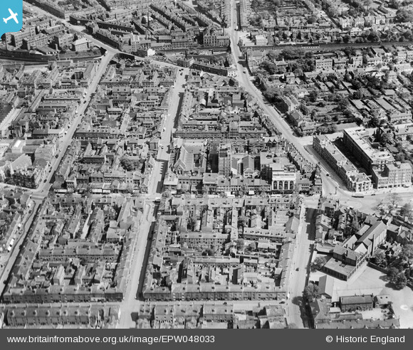
EPW048033 ENGLAND (1935). St Martin's Street and environs, Five Ways, 1935
© Copyright OpenStreetMap contributors and licensed by the OpenStreetMap Foundation. 2026. Cartography is licensed as CC BY-SA.
Nearby Images (9)
EPW048033

EPW008262

EPW048031

EPW048028

EPW048030

EPW048032

EPW048027

EPW048029

EPW005403

Details
| Title | [EPW048033] St Martin's Street and environs, Five Ways, 1935 |
| Reference | EPW048033 |
| Date | June-1935 |
| Link | |
| Place name | FIVE WAYS |
| Parish | |
| District | |
| Country | ENGLAND |
| Easting / Northing | 405767, 286140 |
| Longitude / Latitude | -1.9150893163682, 52.472792614602 |
| National Grid Reference | SP058861 |
Pins

Griffin |
Monday 16th of November 2015 09:36:39 PM | |
|
Griffin |
Monday 16th of November 2015 09:35:48 PM | |
|
Griffin |
Monday 16th of November 2015 09:35:17 PM | |
|
Griffin |
Monday 16th of November 2015 09:30:14 PM | |
|
Griffin |
Monday 16th of November 2015 09:28:28 PM | |
|
PURCELL |
Sunday 17th of November 2013 11:03:32 AM | |
|
PURCELL |
Sunday 17th of November 2013 11:02:53 AM |